
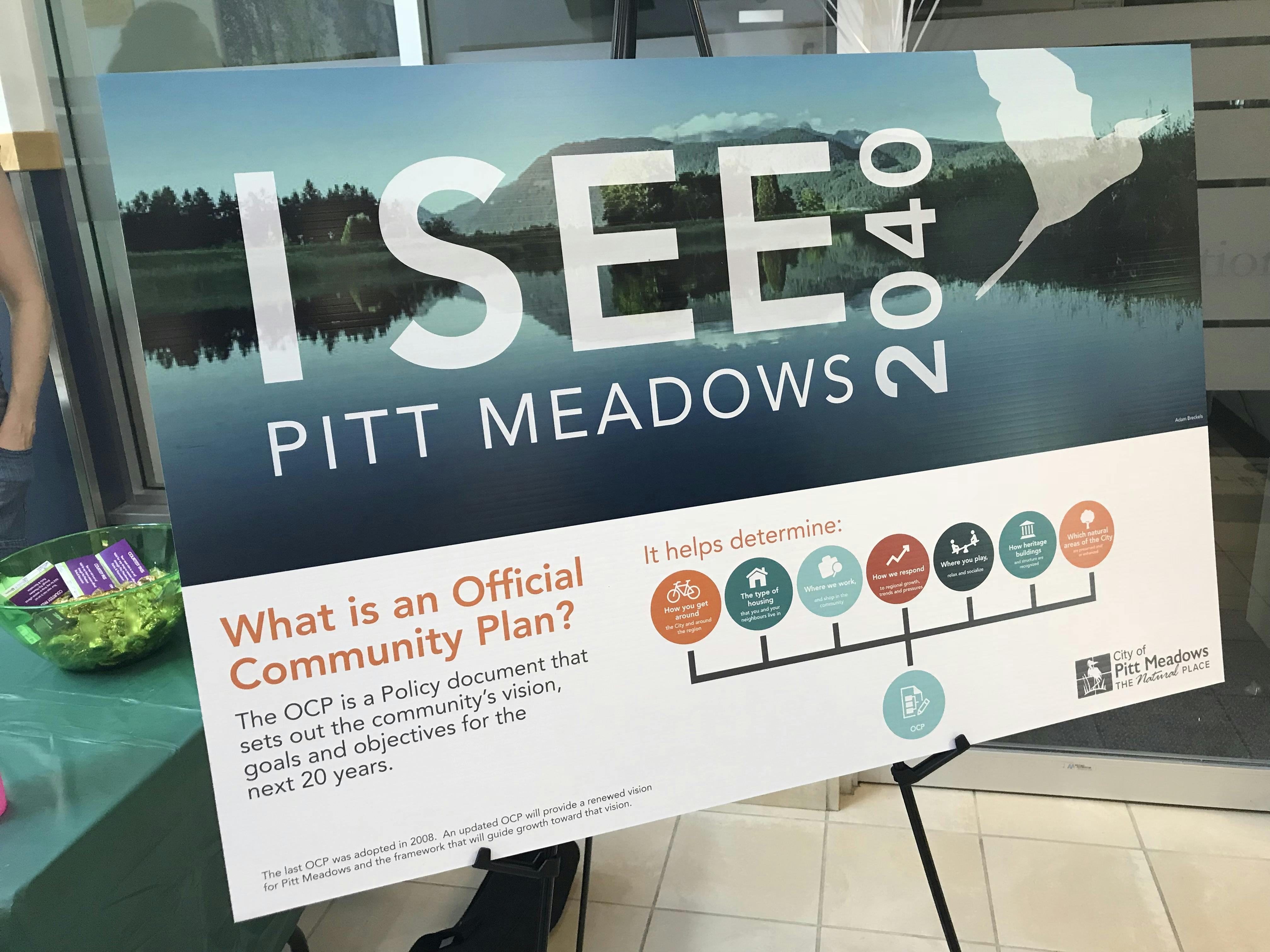
I See Pitt Meadows 2040: Official Community Plan Update

The Official Community Plan (OCP) was adopted by Council on September 27, 2022 after significant engagement and contributions from the community, City staff, and Council since 2018. The City would like to thank the community for their input throughout this project.
Read the Official Community Plan at pittmeadows.ca/ocp.
-
What is a land use map?
A land use map is a schedule within an Official Community Plan. An Official Community Plan (OCP) is a long range (20 year) guide for the municipality that helps Council in making decisions on matters such as land use and growth, transportation, agricultural preservation, economic development, and housing. It is a vision for how we want our city to grow and change.
Land use maps set out the big picture vision for an area. They are high level overviews of how an area or neighbourhood will develop. A land use map differs from the Zoning Bylaw because it sets out a future vision of the community that Council will then use to guide their decision making, especially in regards to rezoning applications. The Zoning Bylaw is the main tool that the City uses to implement the goals and objectives in land use plans. Zoning is the legal tool that describes what uses are permitted on a property, how buildings are situated on an individual site, as well as building size. It ensures new buildings support the vision in the land use plan.
How this land use map is different from the current land use map?- This draft plan proposes to allow medium density residential development such as townhouses along parts of the Hammond Road corridor. Hammond Road is an arterial route for the community as well as part of Translink’s Frequent Transit Network.
- A “Village” land use designation is proposed to be applied to the corners of Hammond and Blakely Road.
- Double fronting lots between 190 and 190A Streets are proposed to be designated medium density residential development such as townhouses.
- The "Civic Center" Designation is proposed to be updated to permit residential uses.
- The "Residential Low-Density" land use designation will no longer contemplate the further subdivision of most existing lots. Corner duplexes, garden suites and secondary suites would continue to be permitted.
Please have a look at the Draft Urban Land Use Map and provide your feedback on the survey below. Share Draft Future Urban Land Use Map on Facebook Share Draft Future Urban Land Use Map on Twitter Share Draft Future Urban Land Use Map on Linkedin Email Draft Future Urban Land Use Map link
 -
What is a land use map?
A land use map is a schedule within an Official Community Plan. An Official Community Plan (OCP) is a long range (20 year) guide for the municipality that helps Council in making decisions on matters such as land use and growth, transportation, agricultural preservation, economic development, and housing. It is a vision for how we want our city to grow and change.
Land use maps set out the big picture vision for an area. They are high level overviews of how an area or neighbourhood will develop. A land use map differs from the Zoning Bylaw because it sets out a future vision of the community that Council will then use to guide their decision making, especially in regards to rezoning applications. The Zoning Bylaw is the main tool that the City uses to implement the goals and objectives in land use plans. Zoning is the legal tool that describes what uses are permitted on a property, how buildings are situated on an individual site, as well as building size. It ensures new buildings support the vision in the land use plan.
Please have a look at the Draft Rural Land Use Map and provide your feedback on the survey below. Share Draft Future Rural Land Use Map on Facebook Share Draft Future Rural Land Use Map on Twitter Share Draft Future Rural Land Use Map on Linkedin Email Draft Future Rural Land Use Map link
 -
Please read the Discussion Paper and then provide your feedback in the survey below.
 Share OCP Discussion Paper and Survey: Housing and Population Growth on Facebook Share OCP Discussion Paper and Survey: Housing and Population Growth on Twitter Share OCP Discussion Paper and Survey: Housing and Population Growth on Linkedin Email OCP Discussion Paper and Survey: Housing and Population Growth link
 -
Please read the Discussion Paper and then provide your feedback in the survey below.
 Share OCP Discussion Paper and Survey: Environment & Natural Community on Facebook Share OCP Discussion Paper and Survey: Environment & Natural Community on Twitter Share OCP Discussion Paper and Survey: Environment & Natural Community on Linkedin Email OCP Discussion Paper and Survey: Environment & Natural Community link
 -
Please read the Discussion Paper and then provide your feedback in the survey below.
 Share OCP Discussion Paper and Survey: Parks and Recreation on Facebook Share OCP Discussion Paper and Survey: Parks and Recreation on Twitter Share OCP Discussion Paper and Survey: Parks and Recreation on Linkedin Email OCP Discussion Paper and Survey: Parks and Recreation link
 -
Share OCP Discussion Paper and Survey: Hazards and Emergency Management on Facebook Share OCP Discussion Paper and Survey: Hazards and Emergency Management on Twitter Share OCP Discussion Paper and Survey: Hazards and Emergency Management on Linkedin Email OCP Discussion Paper and Survey: Hazards and Emergency Management link
-
Please read the Discussion Paper and then provide your feedback in the survey below.
 Share OCP Discussion Paper and Survey: Agriculture on Facebook Share OCP Discussion Paper and Survey: Agriculture on Twitter Share OCP Discussion Paper and Survey: Agriculture on Linkedin Email OCP Discussion Paper and Survey: Agriculture link
 -
Please read the Discussion Paper and then provide your feedback in the survey below.
 Share OCP Discussion Paper and Survey: Transportation on Facebook Share OCP Discussion Paper and Survey: Transportation on Twitter Share OCP Discussion Paper and Survey: Transportation on Linkedin Email OCP Discussion Paper and Survey: Transportation link
 -
Please read the Discussion Paper and then provide your feedback in the survey below.
 Share OCP Discussion Paper and Survey: Local Systems on Facebook Share OCP Discussion Paper and Survey: Local Systems on Twitter Share OCP Discussion Paper and Survey: Local Systems on Linkedin Email OCP Discussion Paper and Survey: Local Systems link
 -
Please read the Discussion Paper and then provide your feedback in the survey below.
 Share OCP Discussion Paper and Survey: Community Well-Being on Facebook Share OCP Discussion Paper and Survey: Community Well-Being on Twitter Share OCP Discussion Paper and Survey: Community Well-Being on Linkedin Email OCP Discussion Paper and Survey: Community Well-Being link
 -
Please read the Discussion Paper and then provide your feedback in the survey below.
 Share OCP Discussion Paper and Survey: Commercial / Industrial Lands and Employment on Facebook Share OCP Discussion Paper and Survey: Commercial / Industrial Lands and Employment on Twitter Share OCP Discussion Paper and Survey: Commercial / Industrial Lands and Employment on Linkedin Email OCP Discussion Paper and Survey: Commercial / Industrial Lands and Employment link


Event Photo Gallery
Videos
-
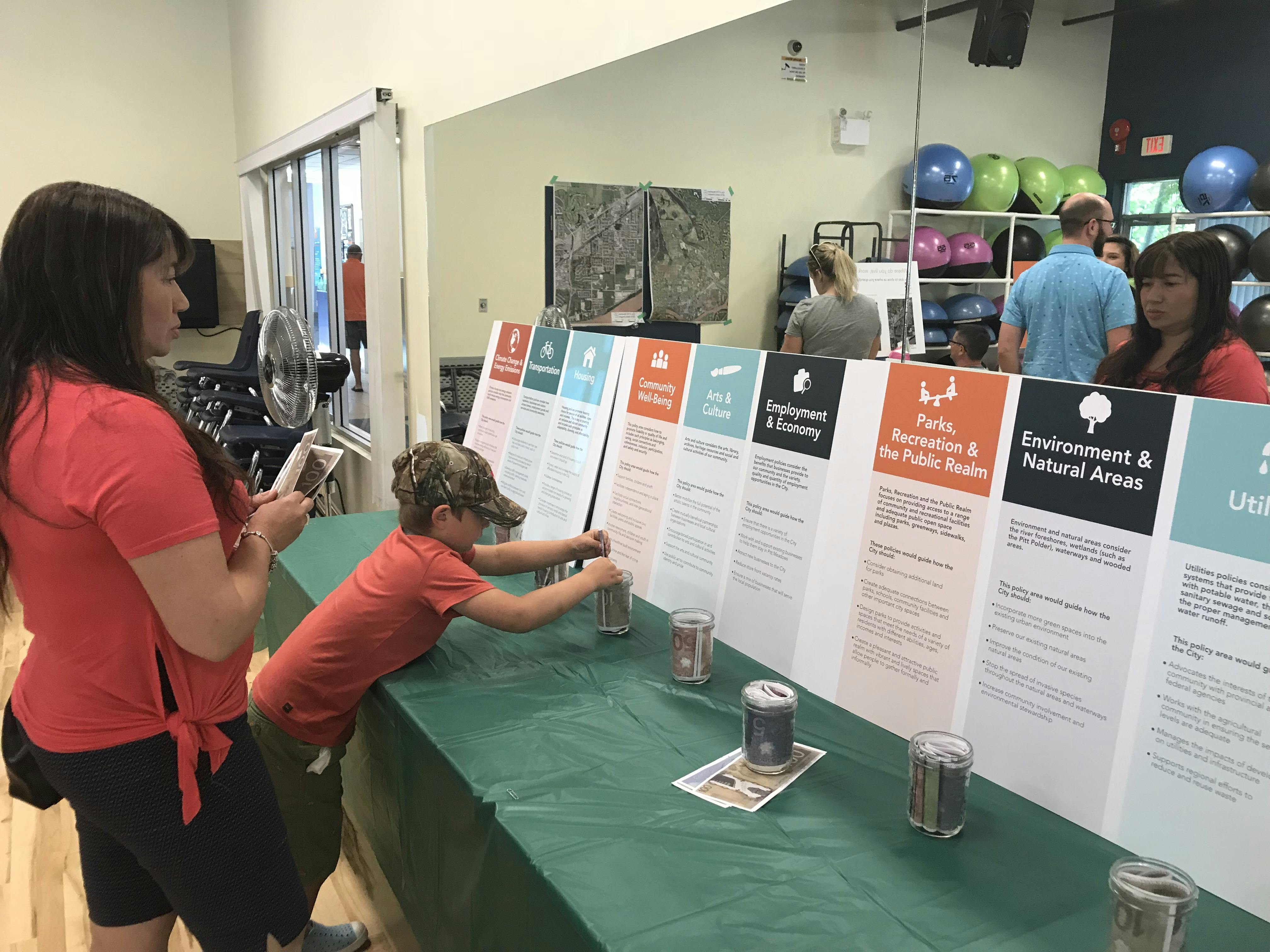
 At the May 12 launch of the Official Community Plan Review, we invited residents to join by sharing their ideas and vision for the future of our community.
Who's listening
-

Phone 604-465-2497 Email dparr@pittmeadows.ca